A big thank you to Sheppard Developements for allowing us to share the images on this page.
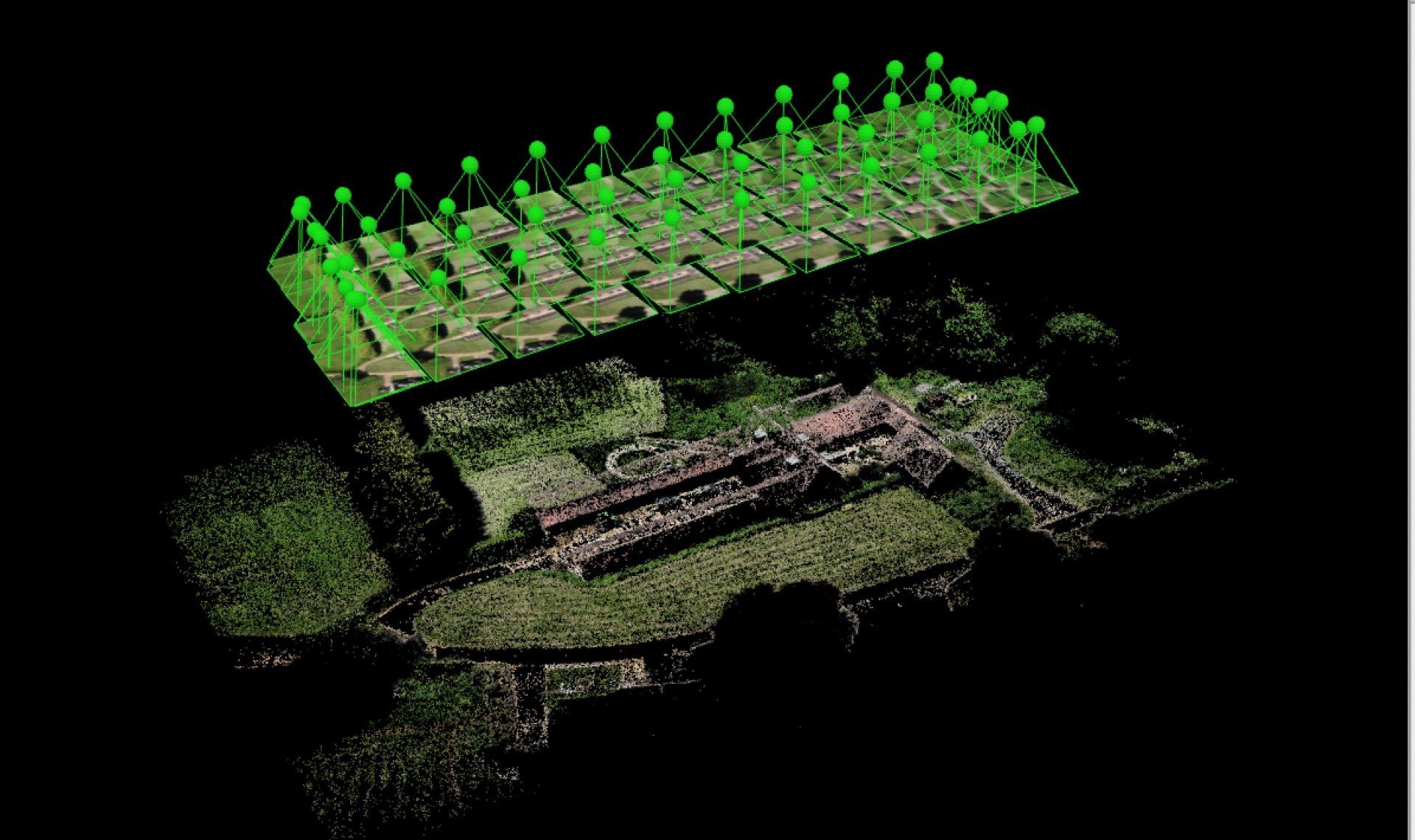
Photogrammetry
Combining multiple photos to create a single image or 3D Model
Skyshutter is pleased to offer various photogrammetry services. Please see the descriptions below or speak to us to determine which best suits your needs.
What is the difference between a single Aerial Photograph and Aerial Photogrammetry?


A single aerial photo will look down from a single point. This gives a vertical perspective to what is directly beneath the camera, however further objects will have more of their sides visible.
Photogrammetry allows the whole of the image to be perfectly vertical across the whole area. This is a process called Orthomosaic Photogrammetry.
Because the photogrammetry utilises many high definition photographs, detail is enhanced.
See example below.

The left image is a single photo exposing the sides of buildings. On the right the Orthomosaic Photogrammetry image retains a vertical perspective throughout in an even higher definition.
3D Modelling
As well as creating a 2D image, we can also take extra images from different heights and angles around an object. This allows us to build a 3D image of the subject. We can then rotate that image on the screen to view it from multiple angles.


As you can see, the 3D model can be viewed from any angle. Measurements can be taken too.
Digital Surface Models (DSM)
A Digital Surface Model, or DSM captures a surface, including natural and human-made structure such as vegetation and buildings. They illustrate reflective surfaces of all features elevated above the ‘bare earth’.
In short, DSMs represent the Earth’s surface and all objects on it.

Because DSMs represent the bare-Earth and all of its above-ground features, they are particularly important in urban planning.
3D surface models can increase the understanding and explanation of complex urban scenarios, especially as built-up areas change with time due to urban expansion.
DSMs are ideal for runway approach zone encroachment in aviation, and urban planning to check how a proposed building may affect views. Beyond that, DSMs can be used for visualization, disaster management, navigation, vegetation management, decision-making, and much more.
Stockpile Volume Calculation
Using the 3D technique above, we are able to measure the dimensions of structures and stockpiles to give an accurate volume estimate.
What are the uses?
There are many uses for photogrammetry including:
- Planning Permission Applications
- Construction Sites
- Building / Asset Inspection
- Stockpile Volume Estimation
- Storm Damage Assessment
- Flood documentation
- Marketing
- Property Sales
- Urban Planning


Contact us today for more information

Other Services